
For the seasoned traveler of the American West, Interstate 5 is a familiar, if somewhat sterile, companion. It is a vein of efficiency, a gray ribbon cutting through the sun-baked Central Valley, where the scenery is defined by the rhythmic pulse of telephone poles and the shimmering heat haze over orchards. It is a road built for the destination.
But there is another way.
To the west, where the continent finally surrenders to the Pacific, lies California State Route 1-the Pacific Coast Highway. If I-5 is a metronome, the Pacific Coast Highway is a symphony. It is a route where the air shifts from the scent of dry earth to the briny perfume of kelp and cold salt spray. Here, the landscape doesn’t just pass by; it rises to meet you in a vertical drama of jagged cliffs, ancient redwoods, and an ocean that shifts from turquoise to indigo with every passing cloud.
For those used to the relentless 75-mile-per-hour pace of the interior, the Pacific Coast Highway demands a different state of mind. It asks you to trade cruise control for the tactile feedback of a winding curve, and the ticking clock for the slow, inevitable rhythm of the tides. It is not merely a detour; it is a pilgrimage to the edge of the world.
Fast Facts for the Coastal Wanderer
Before you trade the valley heat for the coastal mist, here are the essentials for your logbook:
- Total Mileage: Approximately 799 miles (from Dana Point in the south to Leggett in the north), though the most iconic central stretch spans about 240 miles.
- Recommended Travel Time: 3 to 5 days. While you can drive segments in a day, the Pacific Coast Highway is designed for lingering.
- Best Time of Year: September and October offer the “Indian Summer”-the fog clears, the crowds thin, and the air remains warm. Spring (March to May) brings vibrant green hillsides and carpets of wildflowers, though the “June Gloom” fog can linger.
The Geographic Walkthrough: A Journey of Senses
The transition from the I-5 corridor to the coast is often felt before it is seen. As you cut westward-perhaps via Highway 46 through the rolling vineyards of Paso Robles-the temperature drops ten degrees in as many miles. The air becomes heavy, damp, and alive.
The Gateway: San Luis Obispo and Morro Bay
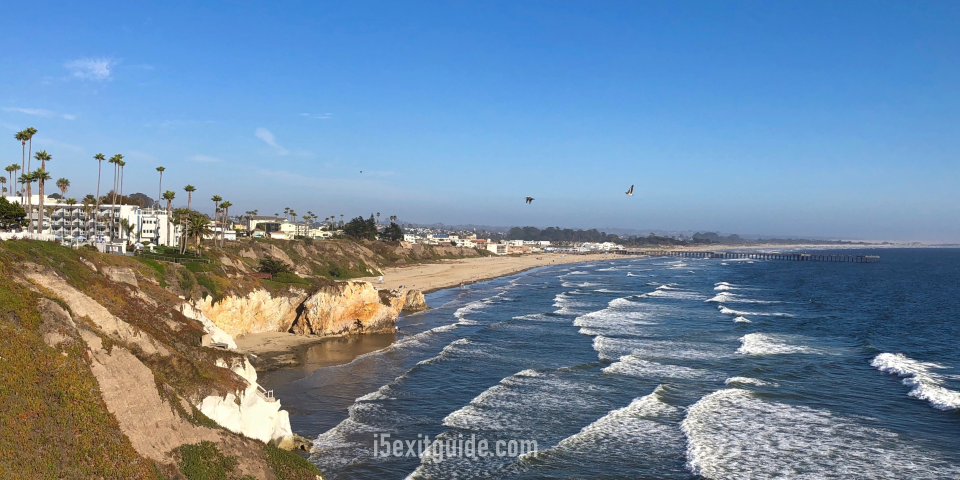
As you merge onto Highway 1, the landscape softens into the Mediterranean charm of the Central Coast. Stop in San Luis Obispo to stretch your legs, but the real magic begins as you approach Morro Bay.
Dominating the horizon is Morro Rock, a 576-foot volcanic plug that stands like a silent sentinel in the harbor. Here, the sound of I-5’s diesel engines is replaced by the haunting cries of peregrine falcons and the barking of sea lions. The air smells of salt-flats and roasting coffee from the waterfront cafes. It is the perfect place to recalibrate your senses for the rugged miles ahead.
The Hearst Realm: San Simeon
Continuing north, the Pacific Coast Highway begins to hug the shoreline more tightly. To your right, the Santa Lucia Mountains rise abruptly; to your left, the Pacific crashes against dark, rocky beaches. In San Simeon, the opulence of Hearst Castle sits perched high on “The Enchanted Hill,” but the true spectacle is at the Piedras Blancas Elephant Seal Rookery.
Step out of the car and listen: the sound is a cacophony of guttural roars and snorts as thousands of northern elephant seals lounge on the sand. The smell is earthy and wild, a reminder that on this road, humans are merely guests in a much older kingdom.
The Cathedral of Nature: Big Sur
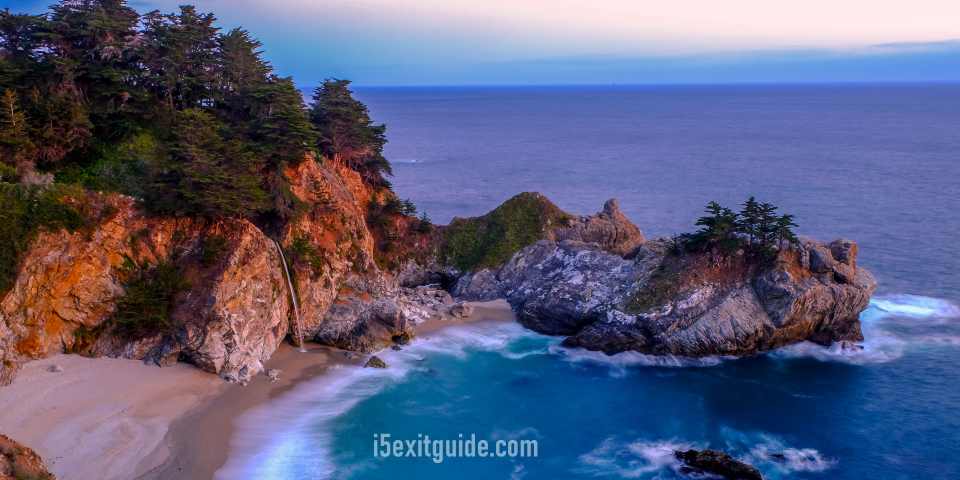
This is the stretch that renders I-5 travelers speechless. For ninety miles between San Simeon and Carmel, the Pacific Coast Highway becomes a narrow tightrope suspended between heaven and high water. There are no stoplights, no strip malls, and-most importantly-no cell service.
You will cross the Bixby Creek Bridge, a concrete arch that looks like a delicate stitch holding two mountains together. Below, the water is a swirling marble of cerulean and foam. At McWay Falls in Julia Pfeiffer Burns State Park, you can witness one of the few “tidefalls” in the world-a silver thread of fresh water dropping 80 feet directly onto a pristine beach. The silence here is profound, broken only by the wind whistling through the dry coastal scrub and the distant, rhythmic thud of the swell.
The Literary Coast: Monterey and Carmel-by-the-Sea
As the road levels out, you enter the mist-shrouded world of John Steinbeck. In Monterey, the scent of the sea is mingled with the history of the old canneries. Walking along Cannery Row, you can almost hear the ghostly clatter of machinery from a century ago.
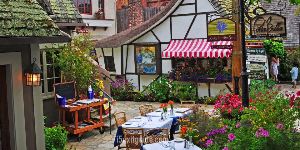
Just south, Carmel-by-the-Sea offers a sensory contrast: the smell of woodsmoke from cottage fireplaces and the sight of white-sand beaches framed by wind-sculpted Cypress trees. It is a place of quiet luxury, a soft landing after the harrowing beauty of the Big Sur cliffs.
The Wild Frontier: Marin County and Beyond
If you continue north past the Golden Gate Bridge, the Pacific Coast Highway transforms again. The “Highway 1” designation takes you through the Point Reyes National Seashore. Here, the landscape feels Scottish-rolling moors, grazing cattle, and a lighthouse perched on a cliff that feels like the end of the earth. The air is sharper here, smelling of damp pine and cold Atlantic-like currents.
Hidden Gems: Where the Locals Linger
While the Bixby Bridge is the face of the Pacific Coast Highway, the soul of the route is found in the places the tour buses overlook.
Partington Cove (Big Sur)
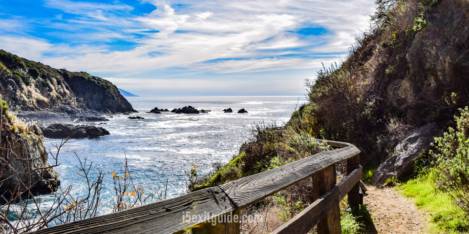
Located at an unmarked pull-off about two miles north of Julia Pfeiffer Burns State Park, this is a secret hidden in plain sight. A steep dirt trail leads down through a forest of towering redwoods, eventually reaching a 60-foot hand-tunneled rock debris tunnel built in the 1880s. Emerging from the dark tunnel, you find yourself at a hidden cove where the water is a startling, crystalline turquoise. It was once a smuggling point for moonshine; today, it is a sanctuary of absolute solitude.
Fiscalini Ranch Preserve (Cambria)
Most travelers rush through Cambria on their way to Hearst Castle, but the Fiscalini Ranch offers a mile of oceanfront bluff trails that are arguably the most beautiful in the state. Instead of looking at the coast from a car window, you walk through rare Monterey Pine forests that grow right to the edge of the kelp forests. It’s a place to watch the whales breach in silence, far from the shutter-clicks of the main overlooks.
Practical Tips for the Coastal Pilot
Driving the Pacific Coast Highway is an art form, quite unlike the “point and shoot” nature of the I-5. To enjoy it, you must respect the geography.
- The Fuel Factor: On I-5, gas stations are every ten miles. In Big Sur, they are rare and can cost twice the national average. Fill your tank in San Luis Obispo or Monterey. Never let your gauge drop below half a tank.
- Road Conditions and Closures: The Pacific Coast Highway is a living landscape. Winter rains often cause mudslides that can close sections of the road for months (particularly around “Paul’s Slide” or “Mud Creek”). Always check the Caltrans website for “Highway 1” updates before you depart.
- Brakes and Gears: The grades are steep and the curves are hairpins. If you are driving an automatic, don’t be afraid to shift into a lower gear (L or 2) when descending into Big Sur to save your brakes from overheating. You’ll smell the burning pads of the tourists ahead of you-don’t let that be you.
- The Turnout Etiquette: The Pacific Coast Highway is meant to be driven slowly, but locals use this road for their daily commute. If you have five or more cars behind you, use the paved turnouts to let them pass. It reduces stress for everyone and allows you to return to your leisurely pace.
- Vehicle Choice: While a convertible is the cliché, a car with a sunroof or large windows is often better. The coastal wind can be biting, even in summer. Ensure your tires have good tread; the road can be slick with “salt mist” even when it hasn’t rained.
Conclusion: The Soul of the West
Interstate 5 is a miracle of logistics, a testament to our desire to get from point A to point B with the least amount of resistance. But life is rarely lived in the straight lines of a multi-lane highway.
The Pacific Coast Highway is a reminder that there is beauty in the detour. It is a road that forces you to be present-to feel the weight of the steering wheel, to notice the shift in the light as the sun dips toward the horizon, and to breathe in an air that has traveled thousands of miles across the open ocean just to reach your lungs.
When you finally pull back onto I-5 to head home, the car might be a little dustier, and your arrival time might be a day later than planned. But your perspective will be shifted. You will carry with you the rhythm of the waves and the memory of the golden hour hitting the Santa Lucia peaks-a sensory souvenir that no interstate could ever provide.
Take the long way. The coast is calling.
The I-5 Exit Guide is the Internet’s largest and most complete website dedicated to Interstate 5 travelers. Find detailed exit service listings… lodging, camping, food, gas and more for every exit from Washington to California!
On the road? Why not take us with you. The I-5 Exit Guide is mobile-friendly and totally FREE. No App Required.
Traveling another route? Visit our growing family of exit guides: I-4 Exit Guide, I-5 Exit Guide, I-10 Exit Guide, I-75 Exit Guide, I-80 Exit Guide and I-95 Exit Guide. Detailed exit service listings… discount lodging, camping, food, gas and more for every exit along the way!


