Live I-5 Traffic Reports: Redding, California
Updated: EST
Stay informed with the latest I-5 traffic updates in Redding, California! Our real-time traffic information provides insights into road conditions, including live updates on construction, accidents, and travel delays. With data continually refreshed, you'll receive the most accurate and timely alerts to plan your journey along one of the country's busiest highways. Whether you're a commuter or a traveler, navigate I-5 with confidence and ease, avoiding congestion and minimizing delays.
Real-Time Redding Area Traffic MapReal-Time traffic information and alerts about accidents, police, and hazards Courtesy of WAZE.com
Redding Area Traffic CamerasLive Feeds From the California Department of Transportation (CalTrans)
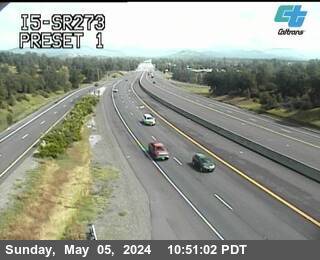
I-5 at SR 273
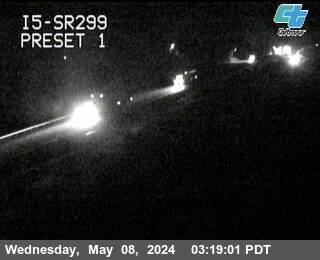
I-5 at SR 299
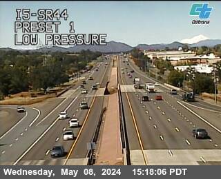
I-5 at junction of SR 44
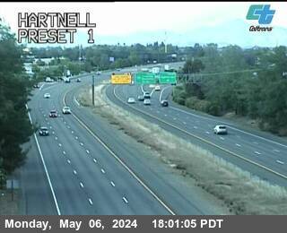
I-5 at Hartnell

I-5 at South Bonnyview
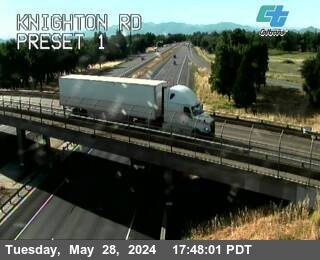
I-5 at Knighton Road
Redding Area Weather Forecast5-Day Weather Forecast Courtesy of Weather Underground
California DOT TweetsSocial Media Posts From The California Department of Transportation (CalTrans)
California Road NewsLatest Headlines From The I-5 Exit Guide Newsroom

I-5 Multi-Lane Closures in Sun Valley for Bridge Repairs June 8-12

Long Delays Anticipated on I-5 for Cottonwood Creek Bridge Work

I-5 Emergency Repairs Project in Sacramento Begins
Redding Area Insider TipsThe Inside Scoop From Seasoned I-5 Travelers
Time your crossing of the Pit River Bridge: This section near Shasta Lake (especially southbound) has some of the worst highway hypnosis on I-5. If you're tired, stop first. The curves and monotony catch people off guard.
Fill up BEFORE Redding: Gas prices spike significantly once you head north toward the Oregon border. Redding is your last chance for reasonable fuel prices for quite a while.
Watch your speed through the Shasta Lake area: California Highway Patrol heavily patrols the stretch between Redding and Mount Shasta, especially near the lake overlooks where people slow down to gawk. The speed limit drops unexpectedly in some zones.
Carry extra water in summer: Temperatures regularly hit 105-115°F from June-September. If you break down, you're in serious heat with limited shade. The AC works overtime here, so make sure your cooling system is solid before this stretch.