I-5 doesn’t have to be a long, boring drive… You’re a little ahead of schedule and you’ve got a few extra hours, so what’s your hurry? Why not take a side trip? Get off the Interstate and discover the real America… small towns, scenic coastlines, historic communities and some of the west coast’s most enjoyable roadtrips.
About The Rogue-Umpqua Scenic Byway
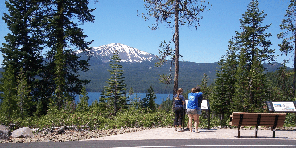
From rolling, oak-covered hills to towering coniferous forests; from roaring whitewater rapids to incised inter-canyon lava flows; the Rogue-Umpqua Scenic Byway invites you to experience 172 miles of diverse river and mountain landscapes. Drive alongside the Upper Rogue and North Umpqua Wild and Scenic Rivers, both of which contain world-class fisheries.
The Rogue-Umpqua Scenic Byway is a National Scenic Byway in the U.S. state of Oregon. From rolling, oak-covered hills to towering coniferous forests; from roaring whitewater rapids to incised inter-canyon lava flows; the Rogue-Umpqua Scenic Byway invites you to experience 172 miles of diverse river and mountain landscapes. Drive alongside the Upper Rogue and North Umpqua Wild and Scenic Rivers, both of which contain world-class fisheries.

Navigating The Rogue-Umpqua Scenic Byway
Rogue-Umpqua Scenic Byway – Oregon
Length: 172.0 mi / 276.8 km
Time: Eight hours to drive this byway
Fees: None
Starting from Roseburg on OR 138, at the junction with Interstate 5, the scenic byway travels eastward. Near Glide, it begins to parallel the North Umpqua River. It continues roughly eastward until it meets Diamond Lake, where it turns southward along the east shore of the lake. Near the southern tip of the lake the scenic byway turns west and then southwest on OR 230. Here it follows the Rogue River, eventually merges with OR 62 near Union Creek. On its last leg the route meets up with OR 234 and passes near Upper and Lower Table Rock. The byway’s terminus is at Gold Hill. The entire sidescenic byway is 172 miles (277 km) long.

Driving Directions: Starting in Roseburg, travel east on SR 138, passing through the towns of Glide and Idleyld Park. Road enters the Umpqua National Forest. Turn south onto SR 230 through the town of Union Creek. Forest boundary ends a few miles past Union Creek. Road turns into SR 62 just before the town of Prospect. Continue southwest until reaching the town of Shady Cove. SR 62 turns into SR 234 just before Gold Hill, where the byway ends.
The I-5 Exit Guide is the Internet’s largest and most complete website dedicated to Interstate 5 travelers. Find detailed exit service listings… lodging, camping, food, gas and more for every exit from Washington to California!
On the road? Why not take us with you. The I-5 Exit Guide is mobile-friendly and totally FREE. No App Required.
Traveling another route? Visit our growing family of exit guides: I-4 Exit Guide, I-5 Exit Guide, I-10 Exit Guide, I-75 Exit Guide, I-80 Exit Guide and I-95 Exit Guide. Detailed exit service listings… discount lodging, camping, food, gas and more for every exit along the way!


